Do you know which crimes were committed in your neighborhood, lately? Crime map shows you the nature of the latest offenses and the location where they were committed, based on information directly from the local police.
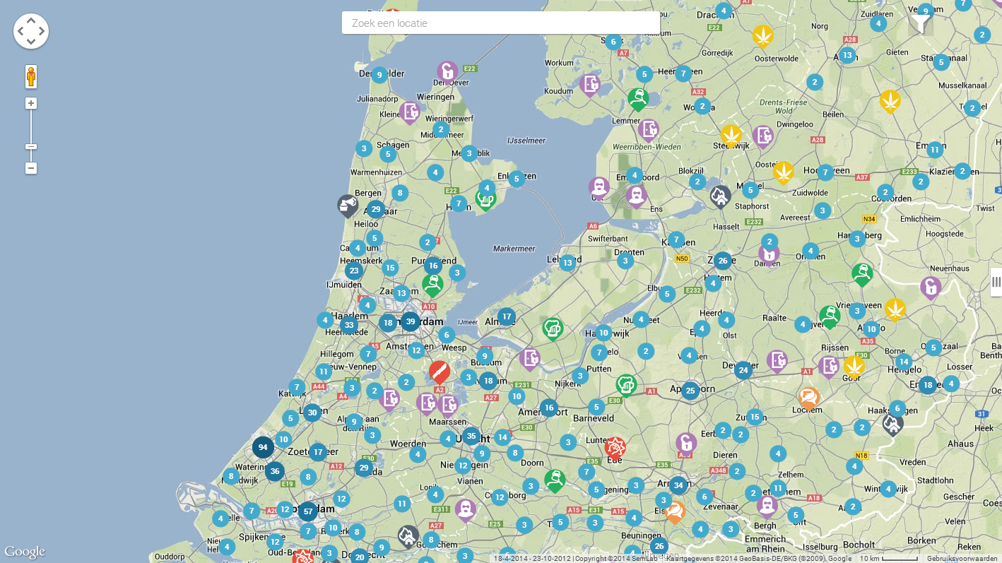
SemLab’s semantic processing system connects to RSS feeds of the Dutch local police. For each news item, the nature of the committed crime and location details (place, street) are extracted. The number of crimes are aggregated to town or area level when using the lower zoom settings, providing a clear overview of the crime rate in the various regions.
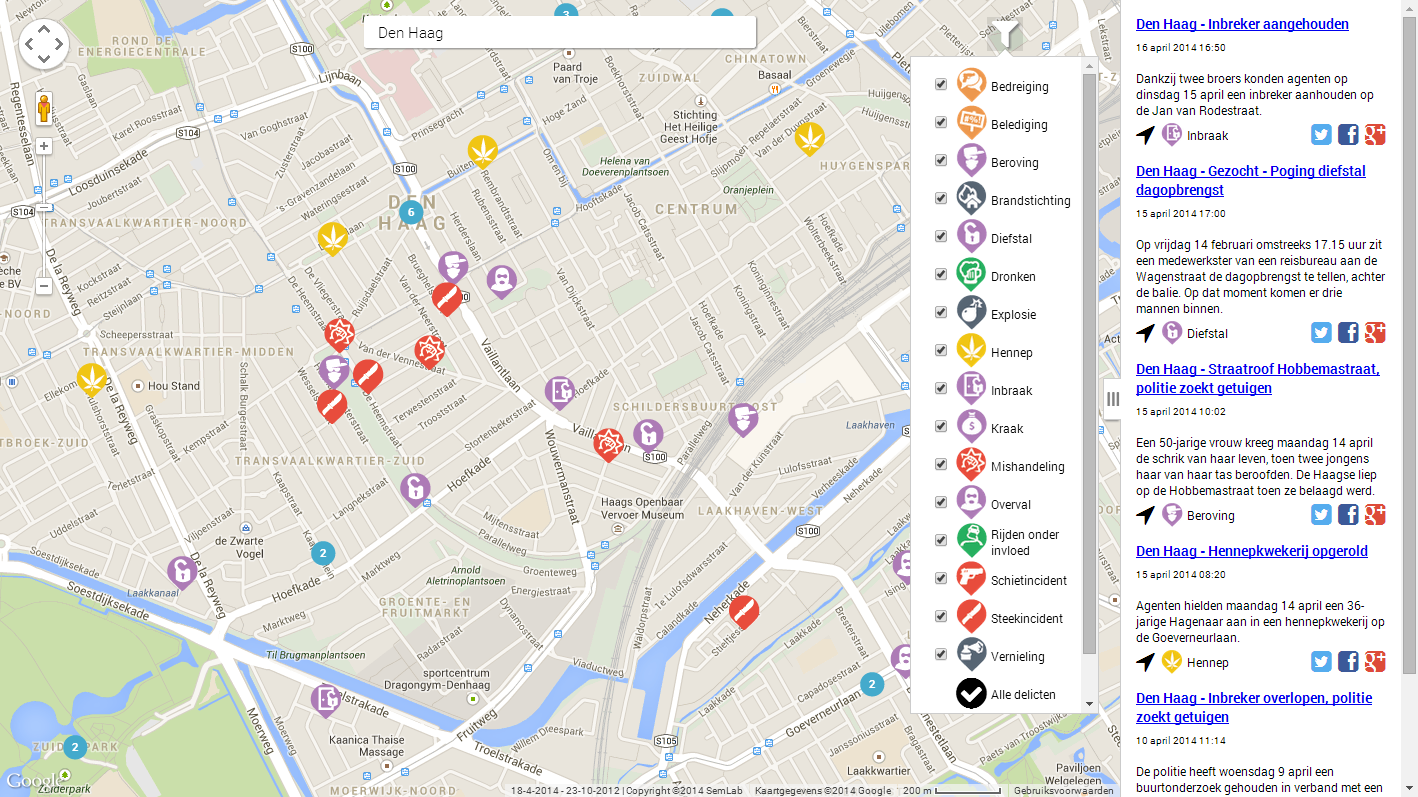
At higher zoom, the crime labels appear indicate the nature of the various crimes. The label is plotted in the exact street where the crime was committed. Clicking an icon, the original news message appears which provides a link to the originating website. Filtering a specific crime or set of crimes is also possible by checking the boxes in the icon list.
A live beta version of this application is available here, but as it is under heavy development, features may not be available at all times.
Due to its nature, this application is available in Dutch language only.
If you are interested in this application or its technology please contact us for a full demonstration of our semantic text processing capabilities.
 Crimikaart beta